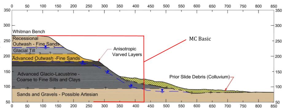
Optum G2 is best at showing where the failure surface is on the slope, rather than the extent of the runout of the slide mass or the total displacement. Because of this, we could not accurately estimate the runout.
A video is not available of the Oso Landslide, which means that the proposed failure mechanism might not represent all parts of the real failure mechanism. Also, Stark et al. mention that the phase 1 slide mass was removed from the slope, meaning that its exact geometry was subjective. The Stark et al. study used information from the 1967 and 2006 landslides occurring on the same slope to estimate groundwater and shear strength conditions.
We are proposing some next steps to be taken for continuation of this project. We used a single material to represent the whole Oso slope. Inputting all six materials found on the Oso slope into Optum G2 would have yielded results more accurately representing the real event. Secondly, we were only able to put in one groundwater table with a simplified slope. More accurately representing the groundwater would be a useful next step. Finally, we were somewhat limited by the academic trial license that we used for Optum G2. Using a different software with more capability would allow us to account for the effects of precipitation on slope stability.